Severe thunderstorms are affecting large parts of South Africa on Sunday, with five provinces placed under impact-based weather warnings for flooding, hail, and damaging winds. The warnings affect Gauteng indirectly through regional storm systems, while the Eastern Cape and KwaZulu-Natal face the highest risk of severe impacts.
According to the South African Weather Service, the storms are being driven by high moisture levels, unstable atmospheric conditions, and extreme heat, increasing the likelihood of flash flooding and infrastructure damage in vulnerable areas.
ALSO READ: Petrol Price Warning in South Africa: What Drivers Must Know Now
Provinces Most Affected by Severe Weather
Impact-based warnings have been issued for several provinces, with storm activity expected to intensify during the afternoon and evening.
The South African Weather Service has identified the following high-risk areas:
• Central and eastern parts of the Eastern Cape
• Western and southern areas of KwaZulu-Natal
• Southern Free State
• South-eastern Northern Cape
• Parts of the Western Cape interior
These areas may experience heavy downpours, hail, strong winds, and frequent lightning.
Gauteng Weather Conditions on Sunday
While Gauteng is not under a severe storm warning, residents can expect unstable conditions, particularly in the southern parts of the province.
Forecast conditions for Gauteng include:
• Hot conditions in the north
• Fine and warm weather becoming partly cloudy
• Isolated afternoon thunderstorms in the extreme south
• High UVB Sunburn Index
Weather officials note that even isolated storms can cause localised flooding, especially in low-lying urban areas with poor drainage.
Breakdown of Conditions in Other Provinces
Mpumalanga
Partly cloudy and warm conditions are expected, with isolated afternoon showers and thundershowers in the extreme south. The Lowveld will remain hot.
Limpopo
The province will experience partly cloudy and hot conditions, with no widespread storm warnings in place.
North West
Partly cloudy and hot weather is expected, with isolated afternoon thundershowers except in the far north-east.
Free State
Warm to hot conditions are forecast, with scattered afternoon showers and thundershowers. Storm activity is expected to be isolated in the north-east.
Northern Cape
Fine conditions along the coast, with morning fog in places. The central and eastern regions may see isolated showers and thundershowers, becoming scattered in the south-east.
Western Cape
Hot conditions in the west, with cloudy and warm weather elsewhere. Rain and showers are possible along the south coast, while the interior may experience afternoon thundershowers. The UVB index is expected to be very high.
Eastern Cape
Widespread showers and thundershowers are expected, particularly along the coast and adjacent interior. Both the western and eastern parts of the province are at risk of flooding.
KwaZulu-Natal
Cloudy and warm to hot conditions are forecast, with very hot temperatures in the north. Isolated to scattered showers and thundershowers are expected, becoming widespread in the west and south. The UVB index is classified as extreme.
Impact-based Weather Warnings Explained
The South African Weather Service has issued the following warnings for Sunday:
Orange Level 5 Warning
Severe thunderstorms with heavy rainfall, damaging winds, hail, and excessive lightning are expected over:
• Central and Eastern Cape
• Western and southern KwaZulu-Natal
These conditions may lead to:
• Flooding of roads and low-lying areas
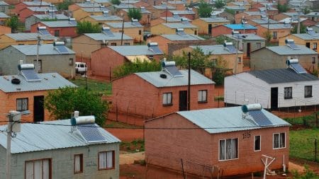
• Damage to infrastructure and informal settlements
• Disruptions to transport routes
• Risk to livestock and livelihoods
Yellow Level 2 Warning
Severe thunderstorms with localised impacts are expected over:
• Southern Free State
• South-eastern Northern Cape
• Interior parts of the Western Cape
• Portions of the Eastern Cape
• Midlands and coastal areas of KwaZulu-Natal south of Richards Bay
Why This Weather System is Significant
Meteorologists say the current storm pattern is consistent with late-summer weather systems driven by high humidity and extreme heat. These systems can produce sudden and intense rainfall, increasing the risk of flash flooding even in areas that are not under formal warnings.
Urban provinces such as Gauteng are particularly vulnerable to short-duration flooding due to high levels of surface runoff.
What This Means for Gauteng Residents
For Gauteng residents, Sunday’s forecast highlights the continued risk of isolated but intense storms, particularly in the afternoon. While the province is not under a severe warning, localised flooding, traffic disruptions and power interruptions remain possible.
Residents are advised to remain alert during storm periods, especially in areas prone to flooding or with known drainage challenges.
FAQ’s
Which provinces are under severe storm warnings
The Eastern Cape and KwaZulu-Natal face the highest risk, with additional warnings for parts of the Free State, Northern Cape and Western Cape.
Is Gauteng under a weather warning
Gauteng is not under a severe warning, but isolated afternoon thunderstorms are expected.
What does an Orange Level 5 warning mean
It indicates a high likelihood of severe weather with significant impacts, including flooding and infrastructure damage.
When will the worst weather occur
Storm activity is expected to intensify during the afternoon and evening.
Who issues South Africa’s official weather warnings
All forecasts and warnings are issued by the South African Weather Service.
What Happens Next
The South African Weather Service will continue monitoring conditions and may update warnings if storm systems intensify or shift. Residents are urged to stay informed as weather patterns can change rapidly during late summer.
Status Check will provide updates should additional warnings or advisories be issued.


